Hiking Squirrel Point/Bald Head in Arrowsic
September is an ideal time for hiking. The weather is cooler and there are far fewer insects to contend with. Two memorable hikes close to the Boothbay and Wiscasset regions are to Squirrel Point and Bald Head, which are located in the nearby community of Arrowsic in Sagadahoc County.
Arrowsic is actually on an island surrounded by three rivers, the Kennebec, Sasanoa and Back rivers. This area has a long and colorful history. First founded by the English in 1650, the original Colonial settlement was overrun by the American Indians during what came to be called King Philip’s War. The island wasn’t settled again until the early 1700s. During this time, two blockhouses were built here for protection of the settlers, although no trace of them can be found today.
Squirrel Point wasn’t named for the bushy-tailed critter that collects acorns, although there are lots of both gray and red squirrels there. According to the legend, long ago in 1717, H.M.S. Squirrel ran aground offshore. The accident caused a great deal of commotion when it was learned Massachusetts Royal Governor Samuel Shute was aboard and making his first trip to Maine. After this, folks got to calling this place “Squirrel Point” and the name stuck.
Getting there by car is easy. Drive southbound on U.S. Route 1 from Wiscasset to Woolwich. Take the Arrowsic-Georgetown exit to Route 127 by the Dairy Queen restaurant.
The exit winds beneath what remains of the Carlton Bridge, and over the tracks of the Maine Eastern Railroad. You’ll soon cross the Sasanoa River Bridge connecting Sasanoa Point in Woolwich with Preble Point in Arrowsic.
Continue on Route 127. Along the way, you’ll pass a vast salt marsh and a small lake on the left, Sewall Pond. Before too long you’ll come to the Bald Head Road on the right. (If you come to the bridge leading to Georgetown, then you’ve gone too far and need to turn around.)
Take Bald Head Road, bearing right after the tarred surface turns to dirt. Follow the road to its very end. Just before you reach it, there’s a small cemetery on your right. There you’ll find the final resting place of Revolutionary War hero Col. Samuel McCobb. In 1779, Col. McCobb led a regiment of Maine recruits in an attack on British-held Castine during the Penobscot Expedition. His grave is easily found marked with a large rounded stone. Next to him rests his wife, Rachel.
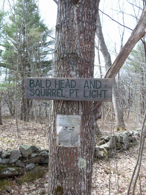
A little ways from the cemetery is a turnaround and parking area. There is no kiosk nor trail maps, but the entrance is readily marked and the trail easy to follow. It slopes downward past a stone wall through the woods. You’ll pass through a towering patch of Sumac which opens to a salt marsh. A wooden footbridge spans a tidal creek there. It’s a pretty picture. Just beyond the bridge the path forks. The trail on the right goes to Squirrel Point, the one on the left to Bald Head.
Squirrel Point is the shorter of the two hikes and takes about 15 to 20 minutes. Winding its way through the woods, the path follows the river. It gradually runs upward and carries you to a cleared area where a small lighthouse stands sentinel. Alongside side it is a high-posted cape that once served as the lightkeeper’s home. There’s also a former boathouse overlooking the shore and oil shed where fuel for the light’s generator was once stored.
The lighthouse, maintained by the U.S. Coast Guard, looks out at the Kennebec River, across the water lies the town of Phippsburg. The white steeple to the left is the Phippsburg Congregation Church. Looking downriver you can see Parker Head. There are plenty of nice spots here where you can enjoy the view while having a picnic lunch. Remember that whatever you carry in, you should carry out. Leave no trace behind. The area is maintained by a group of volunteers called Citizens for Squirrel Point.
On the return walk you can explore the site of a pioneer family’s home. Its cellar hole can be found a short distance south and west of the small footbridge spanning the inlet. The spot is near some second generation apple trees. The footprint of ruins reveal this was a sizable home and had a commanding view of the Kennebec River.
The hike to Bald Head is much longer, but scenic and enjoyable. Allow yourself about an hour to get there. The last part runs uphill, but the climb is worth it. When you reach the summit you’ll be rewarded with a fine view. From here you can see where the Back and Kennebec rivers converge. A short distance from shore is a small chain of islands called the Crow Islands beyond which is Georgetown.
An avid hiker can do both trails in a single day, although many people prefer to do the hikes on separate visits. Both trails are well marked, but it’s always a good idea to carry along a compass and take a bearing before you start. Another good practice is to carry along a topographical map of the area or GPS device.
Event Date
Address
United States


