Scenic views abound along Eaton Farm Preserve’s South Loop
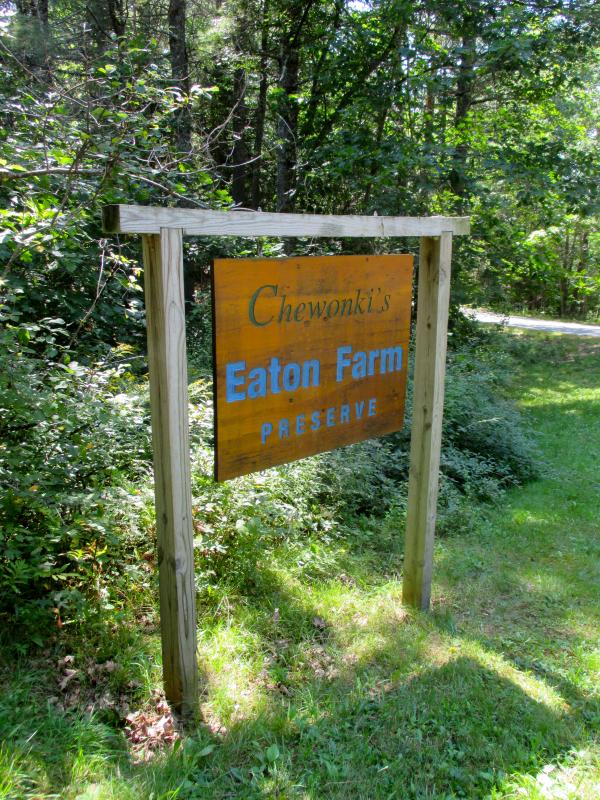
 The entrance into the Eaton Farm Preserve on the Ready Point Road, Wiscasset owned and maintained by Chewonki Foundation. The preserve has two trails, the South Loop and North Loop. PHIL DI VECE/Wiscasset Newspaper
 The entrance into the Eaton Farm Preserve on the Ready Point Road, Wiscasset owned and maintained by Chewonki Foundation. The preserve has two trails, the South Loop and North Loop. PHIL DI VECE/Wiscasset Newspaper
The Eaton Farm Preserve of Chewonki’s Back River Trail system offers some of the most scenic hiking in Wiscasset.
To get there, drive 3.2 miles south from the Wiscasset Municipal Building on Route 1 until you come to the Route 144 exit. (It will be on your left by Norm’s Used Cars.) Turn here and continue until you come to Ready Point Road, the third turn on the right just past the airport. Follow the road until you come to the fork and bear left and the entrance of Eaton Farm Preserve.
It’s a dirt road, and there are a few ruts and big rocks to navigate around, so take it slow. As you round the curve you’ll pass the site of the old Eaton Farm. The farmhouse was on the right on a small knoll that faced the river. The home site can be found at the top of rise to the left of several towering pine trees. A stone fence marks what was once the property’s southern boundary.
The road ends at large parking area; you’ll see a kiosk with information about the trails. No trail maps were available when I was there this past Thursday. You can download a trail map by going to www.wiscasset.org. Go to: “visit” then “community trails.” Click on Map 5, Chewonki Neck and the Eaton Farm.
There are two trails to explore the North Loop and South Loop. For this story we’ll only concern ourselves with the South Loop. It’s an easy and enjoyable hike, roughly a mile from start to finish. Give yourself about an hour to traverse it.
The trail begins just beyond the kiosk and to the right. It runs roughly south by southwest. Running through the woods, it’s nicely shaded. The trail is hard-packed, although mountain biking it would be a challenge because there are a fair amount of roots and rocks along the way.
The path initially runs parallel to the Young’s Point Road. The way is marked with small tin Back River Trail discs, white with a blue Osprey on them. They appear at irregular intervals tacked to trees and are kind of fun to watch for.
In about 10 minutes you’ll come to the small point that looks out into the Back River. To your left is Broad Cove; across it on the opposite shore is Young’s Point. On a map you’ll see that these twin points of land are really one large peninsula that give it a shape akin to a lobster claw. This spot is about the halfway point and makes an ideal place for a picnic lunch. Remember to leave no trace behind. Whatever you carry in be sure to carry out.
Returning to the main trail the route continues around a small tidal inlet and over a brook. The terrain rises as the path winds its way around the point. As it swings northwards you’ll see a sizable stone embankment supporting what was once a wagon road. It lies inland on a small rise. Judging by the stonework a good deal of time was spent in its construction. You can trace the road’s route twisting and turning northward back to the meadow. A hundred years ago this was all cleared land where hay was cut.
Returning to the main trail you’ll soon come to the second lookout. Facing northeast across the river you’ll see Foxbird Island. Beyond it is Bailey Point, the one time site of the Maine Yankee Nuclear Power Plant. The atomic plant was in operation there from 1972 until it closed in 1996 and was taken down. It was Maine Yankee that donated the Eaton Farm property to Chewonki Foundation in 2007.
Walking along the riverbank, I surprised six black ducks that took flight at the first sight of me. There was also an osprey circling above the river, it soon swooped down and plucked a fish from the water in its talons.
The trail runs northwards through the woods to the meadow. There are no markers here, but following the tree line on your right will bring you back to the parking area. The meadow was actually being mowed the day of my hike.
The Back River Trail is owned and maintained by the Chewonki Foundation. It’s open year-round. Motorized vehicles are not allowed on the preserve. Camping and campfires are also prohibited. Hunting is permitted here during hunting season. The Eaton Farm trails and another one on Chewonki Neck are all part of a larger trail system that includes the Cushman Mountain Preserve.
Event Date
Address
United States


