Westport’s Clough Point Preserve
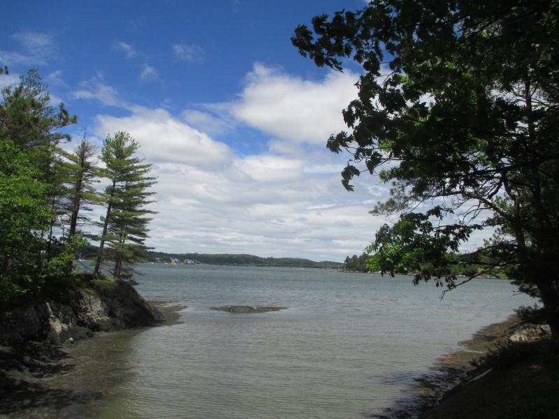
 Looking north from the Clough Point Preserve on Westport Island. PHIL DI VECE/Wiscasset Newspaper
 Pink Lady’s Slippers in bloom at the Clough Point Preserve. The blossom shouldn’t be picked. PHIL DI VECE/Wiscasset Newspaper
 Looking north from the Clough Point Preserve on Westport Island. PHIL DI VECE/Wiscasset Newspaper
 Pink Lady’s Slippers in bloom at the Clough Point Preserve. The blossom shouldn’t be picked. PHIL DI VECE/Wiscasset Newspaper
The Clough Point Town Preserve on Westport Island is ideal for an enjoyable walk or picnic lunch. Located on the north end of Westport Island, the eight-acre preserve is about a 10-minute drive from Wiscasset. It abuts the Back River offering some beautiful views of Wiscasset harbor and Fort Edgecomb.
From Wiscasset take State Route 144, also known as Birch Point Road, and head to Westport. After crossing the Westport Bridge, turn left on North End Road and follow it almost to its end. The preserve will be on your left a little ways past the Boatyard Road. You’ll see a small parking area and a kiosk with rules for enjoying the preserve. The preserve has a handicapped access trail and handicap parking space.
The path from the kiosk leads to a small inlet with steep rocky sides. In bygone days, it served as a natural landing spot for vessels. From here you can either go left and follow the “Camp Molly Loop” or right, the “Clough Point Trail.” Both offer nice river views and have a number of picnic tables along the way and granite benches inscribed with the names of donors.
During my recent visit, I saw a dozen or more Pink Lady’s Slippers in full bloom. They’re a member of the orchid family and bloom in June and early July. They take a number of years before maturing into flower-bearing plants and shouldn’t be picked.
A small rise on the Camp Molly Loop offered a view of the former Mason Station power plant across the river on Birch Point. The generating station built in the 1940s was once owned and operated by Central Maine Power Co. It was decommissioned in 1991 and now sits abandoned.
The Clough Point Trail runs roughly northeast along the wooded shore. Just past the inlet are two more scenic overlooks offering views across Wiscasset Bay. This is the widest part of the Sheepscot River. On the far side you can see the brick former Custom House, the steeples of the Congregational and Episcopal churches, the town clock and Castle Tucker.
The path surrounded by pine and oak trees ends near the island’s northernmost point overlooking the narrow river channel where the Sheepscot and Back rivers converge. In Colonial times, this was called “Decker’s Point,” named for an early pioneer, possibly Joseph Decker who operated a trading post here when the island was still known by the name of “Jeremy Squam.”
The rushing waters are often choppy, filled with many swirling eddies and whirlpools. When the tide is running, the river current here runs from four to six knots. This place is a favorite spot for harbor seals that can be seen feeding here almost any time of day. It’s also a popular place for lobstermen.
The distance separating Westport from the Davis Island shore in Edgecomb is about half a mile. You’ll see Fort Edgecomb’s blockhouse built for defense of the harbor during the War of 1812 and its massive stone batteries overlooking the shore. For added protection against a British attack a second fortification was built in 1814 on Clough Point. It was called Fort McDonough and I seem to recall reading that it was star-shaped; no trace of its earthen ramparts remain today.
The Clough Point Preserve was purchased in 1971 with private contributions and Federal Land and Water Conservation Funds. Funding for maintenance of the trails is provided by the town and the Maine Deptartment of Conservation.
The preserve is open during daylight hours. Dogs are permitted here but need to be under their owner’s control at all times. No overnight camping or fires are allowed. Remember whatever you carry in, to carry out. Parties over nine persons need permission of the town office before using the preserve. Visitors are asked not to pick any wild flowers.
Event Date
Address
United States


