Newcastle’s Marsh River Preserve
 The Marsh River Preserve in Newcastle has an interpretive map listing points of interest along the trail system. PHIL DI VECE/Wiscasset Newspaper
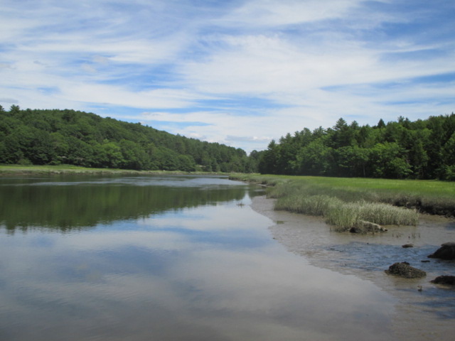
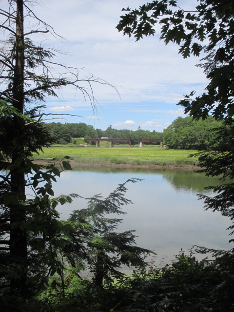
 Saltwater marshes provide an important habitat for fish and birds. In the distance is a railroad bridge spanning the Marsh River as seen from SVCA’s Marsh River Preserve in Newcastle. PHIL DI VECE/Wiscasset Newspaper
 The Marsh River Preserve in Newcastle has an interpretive map listing points of interest along the trail system. PHIL DI VECE/Wiscasset Newspaper
 Saltwater marshes provide an important habitat for fish and birds. In the distance is a railroad bridge spanning the Marsh River as seen from SVCA’s Marsh River Preserve in Newcastle. PHIL DI VECE/Wiscasset Newspaper
Just a short distance from busy U.S. Route 1 in Newcastle are the Marsh River and Marsh River Bog preserves. The 70-acre Marsh River Preserve includes a mile-long Interpretive Trail and is managed by the Sheepscot Valley Conservation Association. It’s located just over the Edgecomb-Newcastle line.
Driving northbound from Wiscasset, turn left at the entrance for Split Rock Distilling onto the gravel Osprey Point Road. Bear left where it forks and becomes Eagle Point Road and follow it to its very end. A small kiosk marks the trailhead; there’s plenty of room to park.
Like other SVCA properties, there’s just one trail leading into and out of the preserve with several smaller side paths to explore. The main trail runs northeast to southwest. The rules for enjoying the preserve are posted at the kiosk along with a guest book. Be sure to sign in, it’s important for SVCA to know how many folks are visiting the preserve. Guests are encouraged to pick up an interpretive map that lists 10 points of interest along the trail, each marked with a numbered sign to correspond with a brief description.
The first is a witch hazel tree. These are pretty common in the woods and seem to grow best in marshy areas. The tree’s bark and leaves are made into a popular healthcare product, “witch hazel,” used as an astringent for treating insect bites and poison ivy. Further along you’ll see a small patch of rattlesnake plantain, so named because of the markings on its leaves. It was just coming into bloom, its flower appearing on a long stalk.
The path is easy to follow, sloping gradually downhill at the outset. Logs and boardwalks span the wet areas. As you might expect, because of the lack of rain this summer, the woods are very dry. The main trail runs along the Marsh River that is tidal, fed by the waters of the Sheepscot River.
At the far end of the preserve the Marsh River splits. One fork forms the much smaller Deer River, the other feeds into Sherman Marsh on the opposite side of Route 1 where there’s a rest stop and picnic area.
A little over 10 years ago this same marsh was a freshwater lake of over 200 acres. Sherman Lake as it was called was completely drained following a storm surge that washed out an earthen dam built by the state in the 1930s. In January 2006 the Maine Department of Transportation announced it wouldn’t replace the dam, allowing the drained area where the lake had been to return to salt marsh.
Back on the preserve, two side paths offer nice places for picture-taking of the river and salt marsh. The best time to catch sight of a great blue heron or egret is usually in the early morning or evening. Several ospreys have been seen nesting in this area. Saltwater marshes and meadows provide important breeding grounds for ducks. Many kinds of fish including striped bass spawn in these brackish waters.
The trail system of Marsh River Preserve covers about a mile and is suitable for all ages. We carried along insect repellent during our recent visit but because it was midday didn’t need it.
This summer, SCVA is offering geocaching in the Sheepscot Watershed. Five of the SVCA preserves have a geocache hidden somewhere on their property. You can earn a prize if you locate and log all five geocache sites. To learn more, visit www.sheepscot.org.
Earlier this year, SVCA merged with the Damariscotta Lake Watershed Association, Hidden Valley Nature Center and Sheepscot Wellspring Land Alliance. Together the groups make up the Midcoast Conservancy, which has an office at 36 Water Street in Wiscasset.
Event Date
Address
United States


