The Zak Preserve in Boothbay-Edgecomb
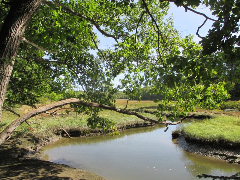
 At over 200 acres, the Zak Preserve spanning Boothbay and Edgecomb is the Boothbay Region Land Trust’s largest preserve. PHIL DI VECE/Wiscasset Newspaper
 Footbridge in the Zak Preserve. PHIL DI VECE/Wiscasset Newspaper
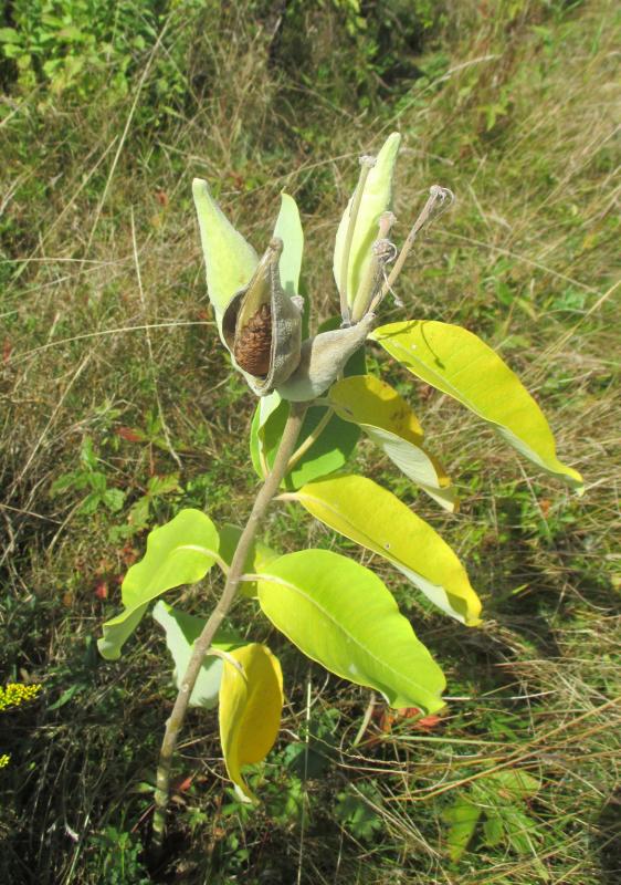
 Milkweed pods are another sign that autumn is here. PHIL DI VECE/Wiscasset Newspaper
 At over 200 acres, the Zak Preserve spanning Boothbay and Edgecomb is the Boothbay Region Land Trust’s largest preserve. PHIL DI VECE/Wiscasset Newspaper
 Footbridge in the Zak Preserve. PHIL DI VECE/Wiscasset Newspaper
 Milkweed pods are another sign that autumn is here. PHIL DI VECE/Wiscasset Newspaper
The full Harvest Moon has come and gone, and the autumnal equinox has arrived, meaning shorter, cooler days that are ideal for early morning or midday hiking.
Just over the Boothbay line on Route 27 is the Zak Preserve offering 2.5 miles of trails to enjoy. At just over 200 acres, it’s the largest preserve owned and maintained by the Boothbay Region Land Trust. It stretches from Route 27 to River Road in East Edgecomb. A portion of it borders a small tidal stream called Wildcat Creek.
Coming from Route 1, the preserve entrance is marked with a sign on the lefthand side of the road. A kiosk by the parking area includes rules for enjoying the preserve, which is open year-round, dawn to dusk. There were plenty of maps available during our visit but no logbook for visitors to sign. Dogs need to be leashed.
There are two main trails; the shorter “white” loop runs alongside the creek. It leads to the longer “yellow” trail that’s 1.5-miles in length. Both are well-packed and easy to follow. The creek is fed by the Back River located on the opposite side of Route 27.
We started down the white trail. Along the way, we saw bunches of blooming wild blue asters along the creek and patches here and there of ripe red partridge berries. Several side paths lead to the creek. Another opens to a large meadow of marsh grass that in a few weeks will turn from green to golden yellow as the autumn progresses.
The white trail leads into and becomes the yellow trail running northeast. It carries you into the woods over mostly level terrain. One stretch lies beneath a canopy of hemlock and pine trees well-shaded even at midday. It thins out again after you cross a small footbridge.
The trail eventually forks, the main path looping back to the parking area. The other leads across the town line into Edgecomb into the eastern half of the preserve, although a sign posted on a tree states that this section is no longer maintained. We didn’t venture down it.
Heading back, the path widens to what was once a tote road snaking through patches of cinnamon fern. A tumbling rock wall on the eastern side marks a former boundary line.
Along the way were a series of small gullies running downhill. They appeared symmetrical like a skidder had left them during a logging operation from long ago. They seemed to have widened into rivulets over the years, although the woods are very dry this summer. Stretches of the trail are hard-packed from the drought — like walking on cement.
The path ends at a meadow filled with golden rod and milkweed where dozens of dragonflies were buzzing about. Sometimes called the "Devil's darning needles," dragonflies are harmless and eat troublesome insects like midges and mosquitoes.
The preserve is part of the Damariscotta River-Link that includes nearby preserves in Edgecomb and Newcastle. The preserve became a part of the BRLT after Michael and Roxanne Zak donated significant funds towards the purchase of 149 acres here in 2003. The Zaks later donated 52 acres or their own property. For more information about it and other BRLT preserves, visit www.brlt.org.
Just a reminder that hunting season resumes in Maine statewide on Oct. 1. Before starting out on a hike, it’s always a good idea to see whether the land preserve you want to explore permits or prohibits hunting.
Event Date
Address
United States


